


trail plans d'hotomnes avec Steve

bubufred
User
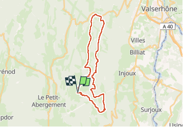

Length
29 km

Max alt
1351 m

Uphill gradient
702 m
Km-Effort
38 km

Min alt
1039 m

Downhill gradient
702 m
Boucle
Yes
Creation date :
2024-10-25 05:21:50.155
Updated on :
2024-10-27 16:16:15.787
5h28
Difficulty : Very easy

FREE GPS app for hiking
 SityTrail
IGN / Geographical institutes
SityTrail Plus
The world is yours!
About
Trail Trail of 29 km to be discovered at Auvergne-Rhône-Alpes, Ain, Haut Valromey. This trail is proposed by bubufred.
Positioning
Country:
France
Region :
Auvergne-Rhône-Alpes
Department/Province :
Ain
Municipality :
Haut Valromey
Location:
Hotonnes
Start:(Dec)
Start:(UTM)
709192 ; 5102079 (31T) N.
Comments